 NERC Data Catalogue Service
Natural hazards
Type of resources
Topics
Keywords
Contact for the resource
Provided by
Years
Formats
Representation types
Update frequencies
Scale
-
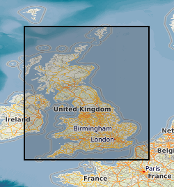
The BGS Debris Flow Susceptibility Model for Great Britain v6.1 is a 1:50 000 scale raster dataset of Great Britain providing 50 m ground resolution information on the potential of the ground, at a given location, to form a debris flow. It is based on a combination of geological, hydrogeological and geomorphological data inputs and is primarily concerned with potential ground stability related to natural (rather than man-made) geological conditions and slopes. The dataset is designed for those interested specifically in debris flow susceptibility at a regional or national planning scale such as those involved in construction or maintenance of infrastructure networks (road or rail or utilities), or other asset managers such as for property (including developers and home owners), loss adjusters, surveyors or local government. The dataset builds on research BGS has conducted over the past 15 years investigating debris flows. The model was designed to identify potential source-areas for debris flows rather than locate where material may be deposited following a long-run-out failure i.e. the track and flow of debris. This work focuses on natural geological and geomorphological controls that are likely to influence the initiation of debris flows. It therefore, does not consider the influence of land use or land cover factors.
-
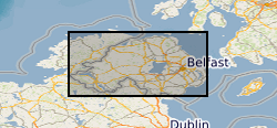
The joint PHE-GSNI-BGS digital Radon Potential Dataset for Northern Ireland provides the current definitive map of radon Affected Areas in Northern Ireland. The Radon Potential map for Northern Ireland shows the estimated percentage of homes in an area exceeding the radon Action Level. This is the basic information to assigning the level of protection required for new buildings and extensions, as described in the Building Research Establishment guidance BR-413 Radon: Guidance on protective measures for new dwellings in Northern Ireland (2004). The Radon Potential map for Northern Ireland is based on PHE indoor radon measurements and 1:10 000 or 1: 250 000 scale digital geology information provided by the Geological Survey of Northern Ireland (GSNI). The indoor radon data is used with the agreement of the Northern Ireland Environment Agency and PHE. Confidentiality of measurement locations is maintained through data management practices. Access to the data is restricted. Radon is a natural radioactive gas, which enters buildings from the ground. Exposure to high concentrations increases the risk of lung cancer. Public Health England (PHE) recommends that radon levels should be reduced in homes where the annual average exceed 200 becquerels per cubic metre (200 Bq m-3), the Action Level. PHE defines radon Affected Areas as those with 1% chance or more of a house having a radon concentration at or above the Action Level. Further information on radon can be obtained from www.ukradon.org
-

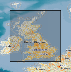
The Debris Flow Susceptibility Model for Great Britain version 6.0 (DFSM_GB_v6.0) provides information on the likelihood of debris flows occurring at a given location based on a combination of digital geological, hydrogeological and topographic data. It is a raster dataset at 50m resolution, showing susceptibility for debris flows on a scale A (lowest likelihood) to E (highest likelihood). The methodology develops an additional dimension to the BGS GeoSure Landslides surface layer (Dashwood et al., 2014) and is designed for users interested specifically in debris flow susceptibility. The identification of debris flow hazards can assist regional planners; rapidly identifying areas with potential problems and aid local government offices in making development plans by helping to define land suited to different uses. Other users of these data may include developers, homeowners, asset owners, solicitors, loss adjusters, the insurance industry, architects and surveyors. The DFSM (Debris Flow Susceptibility Model) GB v6.0 was completed in March 2017.
-
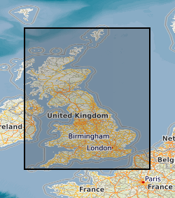
**This dataset has been superseded** The newGeoSure Insurance Product (newGIP) provides the potential insurance risk due to natural ground movement. It incorporates the combined effects of the 6 GeoSure hazards on (low-rise) buildings. This data is available as vector data, 25m gridded data or alternatively linked to a postcode database – the Derived Postcode Database. A series of GIS (Geographical Information System) maps show the most significant hazard areas. The ground movement, or subsidence, hazards included are landslides, shrink-swell clays, soluble rocks, running sands, compressible ground and collapsible deposits. The newGeoSure Insurance Product uses the individual GeoSure data layers and evaluates them using a series of processes including statistical analyses and expert elicitation techniques to create a derived product that can be used for insurance purposes such as identifying and estimating risk and susceptibility. The Derived Postcode Database (DPD) contains generalised information at a postcode level. The DPD is designed to provide a ‘summary’ value representing the combined effects of the GeoSure dataset across a postcode sector area. It is available as a GIS point dataset or a text (.txt) file format. The DPD contains a normalised hazard rating for each of the 6 GeoSure themes hazards (i.e. each GeoSure theme has been balanced against each other) and a combined unified hazard rating for each postcode in Great Britain. The combined hazard rating for each postcode is available as a standalone product. The Derived Postcode Database is available in a point data format or text file format. It is available in a range of GIS formats including ArcGIS (*.shp), ArcInfo Coverages and MapInfo (*.tab). More specialised formats may be available but may incur additional processing costs. The newGeoSure Insurance Product dataset has been created as vector data but is also available as a raster grid. This data is available in a range of GIS formats, including ArcGIS (*.shp), ArcInfo coverage’s and MapInfo (*.tab). More specialised formats may be available but may incur additional processing costs. Data for the newGIP is provided for national coverage across Great Britain. The newGeoSure Insurance Product dataset is produced for use at 1:50 000 scale providing 50 m ground resolution. This dataset has been specifically developed for the insurance of low-rise buildings. The GeoSure datasets have been developed to identify the potential hazard for low-rise buildings and those with shallow foundations of less than 2 m deep. The identification of ground instability and other geological hazards can assist regional planners; rapidly identifying areas with potential problems and aid local government offices in making development plans by helping to define land suited to different uses. Other users of these data may include developers, homeowners, solicitors, loss adjusters, the insurance industry, architects and surveyors. Version 7 released June 2015.
-
The 5km Hex GS Compressible Ground dataset shows a generalised view of the GeoSure Compressible Ground v8 dataset to a hexagonal grid resolution of 64.95km coverage area (side length of 5km). This dataset indicates areas of potential ground movement in a helpful and user-friendly format. The rating is based on a highest level of susceptibility identified within that Hex area: Low (1), Moderate (2), Significant (3). Areas of localised significant rating are also indicated. The summarising process via spatial statistics at this scale may lead to under or over estimation of the extent of a hazard. The supporting GeoSure reports can help inform planning decisions and indicate causes of subsidence. The methodology is based on the BGS Digital Map (DiGMapGB-50) and expert knowledge of the behaviour of the formations so defined. This dataset provides an assessment of the potential for a geological deposit to compress under an applied load, a characteristic usually of superficial deposits such as peat or alluvium. Some types of ground may contain layers of very soft materials like clay or peat. These may compress if loaded by overlying structures, or if the groundwater level changes, potentially resulting in depression of the ground and disturbance of foundations. Complete Great Britain national coverage is available.
-
The GeoSure data sets and reports from the British Geological Survey provide information about potential ground movement or subsidence in a helpful and user-friendly format. The reports can help inform planning decisions and indicate causes of subsidence. Complete Great Britain national coverage is available. The Insurance Data give an index level assessment of the potential for a geological deposit to create financial insurance loss. The methodology is based on the 6 GeoSure individual hazard assessments. The storage formats of the data are ESRI and MapInfo but other formats can be supplied.
-
The data shows the extent of mining within Great Britain it was captured in 1990 by OVE ARUP on behalf of the Department of Environment as a series of paper maps and no updates have been carried out. The data has been converted to a digital format (ESRI shape file) by BGS in 1995. The original scale of the data was 1km square. The dataset has limited attribution indicating type i.e. metalliferous, rock, coal, deneholes (chalk), evaporites or ironstone, and whether definitive evidence was found. Although every effort has been made to attribute the digital data to the original maps some inconstancies may have arisen due to data conversion process.
-
Photos and videos collected during earthquake damage surveys of the village of Amatrice, central Italy. The earthquake struck on the 24th of August 2016 at 3:36 am local time, a Mw 6.2 earthquake struck a mountainous region of central Italy on the borders between Umbria, Marche, Lazio and Abruzzo. The Earthquake Engineering Field Investigation Team (EEFIT) mission ran from the 4th to the 15th of October 2016. The three main aspects investigated were the ground surface effects caused by the earthquake, the structural damage of masonry buildings and bridges and the effects of the earthquake on reinforced concrete structures and infrastructure.
-
The 5km Hex GS Shrink Swell dataset shows a generalised view of the GeoSure Shrink Swell v7 dataset to a hexagonal grid resolution of 64.95km coverage area (side length of 5km). This dataset indicates areas of potential ground movement in a helpful and user-friendly format. The rating is based on a highest level of susceptibility identified within that Hex area: Low (1), Moderate (2), Significant (3). Areas of localised significant rating are also indicated. The summarising process via spatial statistics at this scale may lead to under or over estimation of the extent of a hazard. The supporting GeoSure reports can help inform planning decisions and indicate causes of subsidence. The Shrink Swell methodology is based on the BGS Digital Map (DiGMapGB-50) and expert knowledge of the behaviour of the formations so defined. This dataset provides an assessment of the potential for a geological deposit to shrink and swell. Many soils contain clay minerals that absorb water when wet (making them swell), and lose water as they dry (making them shrink). This shrink-swell behaviour is controlled by the type and amount of clay in the soil, and by seasonal changes in the soil moisture content (related to rainfall and local drainage). The rock formations most susceptible to shrink-swell behaviour are found mainly in the south-east of Britain. Clay rocks elsewhere in the country are older and have been hardened by burial deep in the earth and are less able to absorb water. The BGS has carried out detailed geotechnical and mineralogical investigations into rock types known to shrink, and are modelling their properties across the near surface. This research underpins guidance contained in the national GeoSure dataset, and is the basis for our responses to local authorities, companies and members of the public who require specific information on the hazard in their areas. The BGS is undertaking a wide-ranging research programme to investigate this phenomenon by identifying those areas most at risk and developing sustainable management solutions. Complete Great Britain national coverage is available.
-

The 5km Hex GS Shrink Swell dataset shows a generalised view of the GeoSure Shrink Swell v8 dataset to a hexagonal grid resolution of 64.95km coverage area (side length of 5km). This dataset indicates areas of potential ground movement in a helpful and user-friendly format. The rating is based on a highest level of susceptibility identified within that Hex area: Low (1), Moderate (2), Significant (3). Areas of localised significant rating are also indicated. The summarising process via spatial statistics at this scale may lead to under or over estimation of the extent of a hazard. The supporting GeoSure reports can help inform planning decisions and indicate causes of subsidence. The Shrink Swell methodology is based on the BGS Digital Map (DiGMapGB-50) and expert knowledge of the behaviour of the formations so defined. This dataset provides an assessment of the potential for a geological deposit to shrink and swell. Many soils contain clay minerals that absorb water when wet (making them swell), and lose water as they dry (making them shrink). This shrink-swell behaviour is controlled by the type and amount of clay in the soil, and by seasonal changes in the soil moisture content (related to rainfall and local drainage). The rock formations most susceptible to shrink-swell behaviour are found mainly in the south-east of Britain. Clay rocks elsewhere in the country are older and have been hardened by burial deep in the earth and are less able to absorb water. The BGS has carried out detailed geotechnical and mineralogical investigations into rock types known to shrink, and are modelling their properties across the near surface. This research underpins guidance contained in the national GeoSure dataset, and is the basis for our responses to local authorities, companies and members of the public who require specific information on the hazard in their areas. The BGS is undertaking a wide-ranging research programme to investigate this phenomenon by identifying those areas most at risk and developing sustainable management solutions. Complete Great Britain national coverage is available.